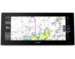
Garmin BlueChart g3 Vison (Australia- Mackay to Esperance Coastal Charts)
$399.00
Our Premium Chart Offering
- Derived from official charts and private sources to provide navigational aids, spot soundings, depth contours, tides and currents, and detailed harbors and marinas.
- Garmin Auto Guidance technology shows a suggested route to a destination¹
- Depth Range Shading for up to 10 depth ranges enables you to view your target depth at a glance
- Up to 1-foot contours provide a more accurate depiction of the bottom structure for improved fishing charts and navigation
- Shallow Water Shading feature allows for depth shading at a user-defined level to aid in navigation
- Unique 3D views like MarinerEye and FishEye provide additional perspective both above and below the water line
- High-resolution satellite imagery of ports, marinas, bridges and navigational landmarks for superior situational awareness
- Worldwide coverage available
- Keep your charts up to date with our industry-leading New Chart Guarantee and discount card update program
- Realistic navigation features showing everything from shaded depth contours and coastlines to spot soundings, navaids, port plans, wrecks, obstructions, intertidal zones, restricted areas, IALA symbols and more.
- Smooth display presentation including seamless transitioning between zoom levels and more continuity across chart boundaries.
- Safety shading allows user to enable contour shading for all depth contours shallower than user-defined safe depth.
- Fishing charts to help scope out bottom contours and depth soundings with less visual clutter on the display.
- High-resolution satellite imagery, when overlaid on the chart, provides the mariner with a realistic view of the land and water for unparalleled situational awareness.
- Aerial reference photography provides “real world” photos of ports, harbours, marinas, waterways, navigation landmarks and other points of interest, offering the mariner another powerful tool for navigating unfamiliar waters.
- MarinerEye view 3-D perspective provides a bird’s eye view from behind the boat showing the chart information for a quick, reliable and easy position fix.
- FishEye view 3-D perspective provides an underwater view that visually represents the sea floor according to the chart’s information.
- Auto Guidance technology searches chart data to suggest the best passage to a destination. Includes tides, currents, marine services, coastal roads and points of interest.
- Compatible with HomePort™ — software that lets you use BlueChart data to conveniently plan and organize routes from your computer before your trip.